Town of Cheraw Stormwater Master Plan
Recent hurricane events and aging infrastructure have caused historic flooding throughout the Town of Cheraw. Using FEMA funding administered through the South Carolina Emergency Management Division (SCEMD), the Town will be developing a comprehensive stormwater master plan. Master planning will be aimed at improving long-term community resiliency against future flood hazards.
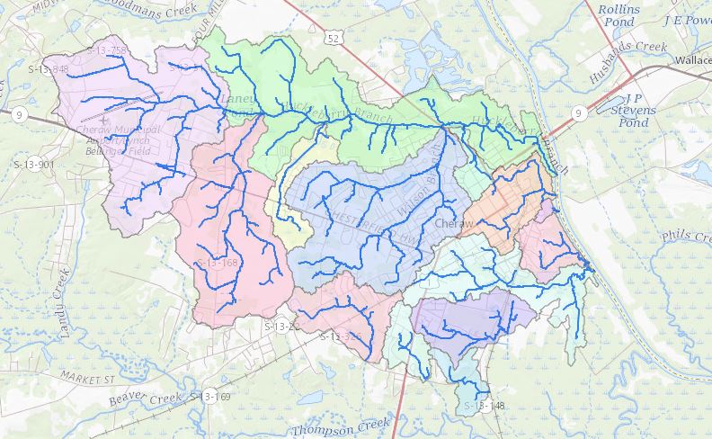
Davis & Floyd provided field survey, inventory, and data collection as well as developing and implementing innovative cloud-based geospatial survey/inventory programs to enhance survey efficiency and productivity. The team created and maintained an innovative cloud-based geospatial flood reporting application for receiving and cataloging public input. In addition, they designed and maintained dynamic web mapping applications to promote client/public engagement and provide real-time project updates.
SERVICES PROVIDED:
- Surveying
- GIS Mapping
- Stormwater Inventory & Assessment
- Watershed Assessment
- 1D/2D Hydrologic/Hydraulic Modeling
- Cost Estimating
- Cost-Benefit Analysis
- Master Planning